MZHK on the territory of the Badaevsky brewery | MARKS GROUP
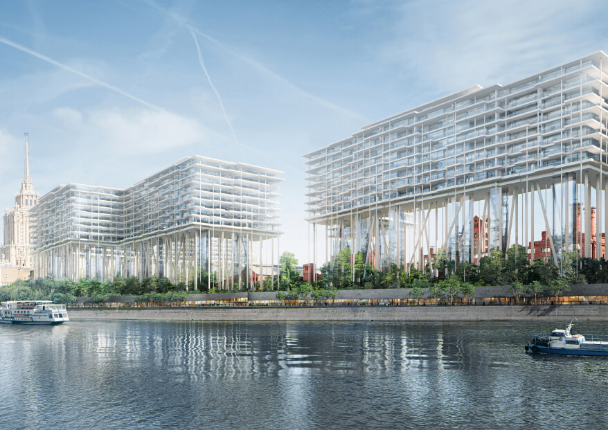
The project is a multifunctional residential complex consisting of 2 residential buildings with built-in public facilities; with retail and catering facilities oriented to the embankment; with underground parking; as well as with fragmentary restoration and adaptation of historical buildings 1 and 3 (cultural heritage sites) on the territory of the Badaevsky Brewery.
APPLICATION OF INFORMATION MODELING TECHNOLOGY
Information modeling technology (BIM) was used in the development of documentation for the Working Documentation stage.
- AR,AI,KR,VIS — Autodesk Revit; Rhino+Grasshopper
- KM — Tekla
- GP,HC — Autodesk Civil 3d;
- Verification and coordination of models — Autodesk Navisworks, BIMCollab Zoom.
- Virtual Reality — Unreal Engine
- Laser scanning — Autodesk Recap
The modeling and coordination process was conducted according to the Customer's Information Requirements (EIR). A project implementation plan (BEP) was formed and agreed with the Customer to coordinate the technology for modeling unique elements and recording deviations from requirements.
The work on the project was carried out using a single information environment. The project files were hosted on a separate Revit Server and linked together by links. This allowed all project participants to see only up-to-date information about the work of other project teams. The models were checked on a weekly basis in two stages: automatic and manual.
The project had several tasks, the solution of which was carried out using mathematical modeling.
During the design, proprietary developments were implemented, such as: Synchro 4D Pro, Unreal Engine, Model Exporter, Hole Manager, Trim Construction, Rhino + Grasshopper, Revit + Dynamo. All this has made it possible to reduce the number of routine repetitive operations and save time for designers.
LEVELS OF DETAIL OF BIM MODELS
Laser scanning and models of cultural heritage sites.
To more accurately reproduce the appearance of cultural heritage sites, this project used the construction of models based on laser scanning of existing buildings. Point clouds of window models were used as a reference substrate for recreating walls, ceilings, openings, and facade elements. The laser scanning results were prepared, processed, and cleaned using the Autodesk Recap program. The exact positioning of the existing buildings of the windows on the site was carried out according to the results of the geodetic survey.
Information models of the complex. The architectural models of the complex were executed in high detail and had the detailed information necessary to create high-quality documentation.
Interior models of public spaces contained highly detailed geometry of decorative elements, end devices, design tiles, doors, navigation elements.
The features of the development of Constructive Solutions include the use of the Tekla Structure software package for the design of metal structures. The models from Tekla were uploaded to the IFC format. Spatial coordination of IFC files was carried out, which were used as links in the development of models of other sections.
During the development of Engineering Networks, starting from the Design Documentation stage, all networks were separated to minimize spatial collisions. To test the solutions for wiring engineering networks in the parking lot, special families of parking spaces with service areas were used, as well as zones of boundary conditions were separately modeled, in the dimensions of which network engineers should conduct their communications.
Based on the results of the installation of networks and equipment on the construction site, the developer provided an executive model. In the models of engineering networks, the project coordinators created verification views that allow them to track the differences between the design and execution models, and promptly make changes to the design model to best match the built facility.